Oxford-Cambridge Route Photo Gallery
The photos on this page show have been taken along the route of the proposed Oxford-Cambridge railway line and will be added to as developments occur.
Last change on 07/12/2020 - Set 9 - New photo set for rebuilt railway between Bicester and Bletchley
The following sets of photographs are available:
- Set 1 - Western Section Phase 2 (5 photos)
- Set 2 - Central Section - Main Photos (10 photos)
- Set 3 - Central Section - Other Photos (15 photos)
- Set 4 - Western Section - Bedford and Bletchley main line stations (7 photos)
- Set 5 - Western Section Phase 1 - Evergreen 3 project (5 photos)
- Set 6 - Central Section - Joint Railfuture and CBT Ox-Cam Walk (4 photos)
- Set 7 - Central Section - Cambridge-Bedford route (19 photos)
- Set 8 - Western Section - Oxford to Oxford Parkway being rebuilt (9 photos)
- Set 9 - Western Section Phase 2 - Bicester to Bletchley being rebuilt (16 photos)
All (90 photos) - possible long download time!
Please click on the photo to see it in a larger non-compressed format.
Photo Set 1 - Western Section Phase 2 |
||
Existing railway between Bletchley and Bicester |
||
Photos taken on 21/03/2009. |
||
At Winslow looking towards Bletchley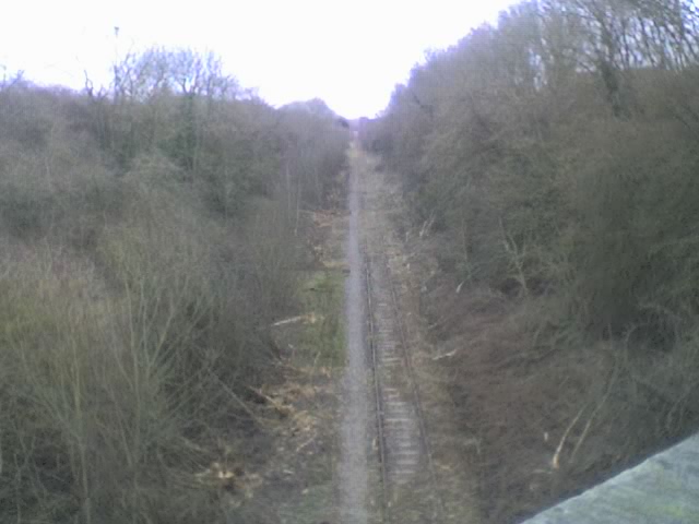 001. OXFORD TO CAMBRIDGE, western section, disused: view at Winslow looking east towards Bletchley showing recent tree clearance. Photo: Peter Bayless |
At Winslow looking towards Bicester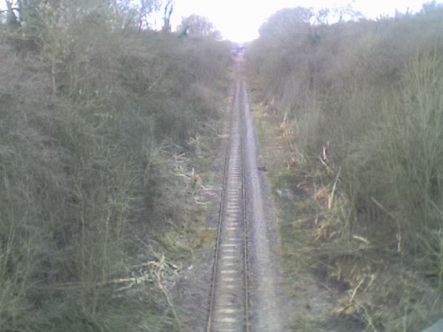 002. OXFORD TO CAMBRIDGE, western section disused: view at Winslow looking west towards Bicester, showing recent tree clearance. Photo: Peter Bayless |
|
At Steeple Claydon looking towards Aylesbury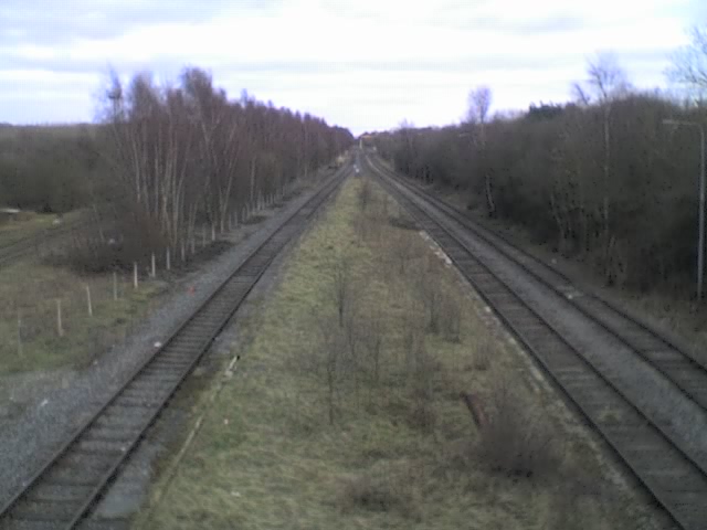 003. OXFORD TO CAMBRIDGE, Aylesbury line, in use by freight trains: view at Steeple Claydon looking south towards Aylesbury showing the route to the Calvert waste disposal terminal (in the distance, to the right of the tracks). Photo: Peter Bayless |
At Steeple Claydon looking towards Claydon junction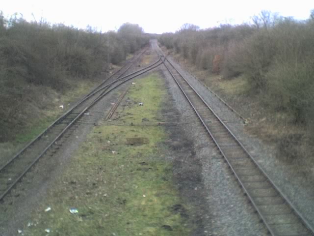 004. OXFORD TO CAMBRIDGE, Aylesbury branch, in use by freight trains: at Steeple Claydon looking north towards the main route (Claydon junction),showing the crossing to the Calvert waste disposal terminal. Photo: Peter Bayless |
|
Nr Charndon looking towards Claydon junction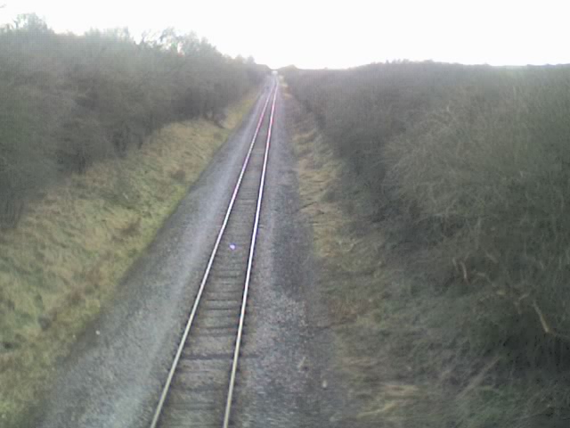 005. OXFORD TO CAMBRIDGE, western section, in use by freight trains: view near Charndon looking west towards Claydon junction. Photo: Peter Bayless |
||
Photo Set 2 - Central Section - Main Photos |
||
The existing Bedford to Hitchin trackbed between Old Warden and the A421 Bedford southern by-pass |
||
Photos taken from 2006 to 2009. |
||
Cardington airship sheds from Greensand Ridge - tunnel beneath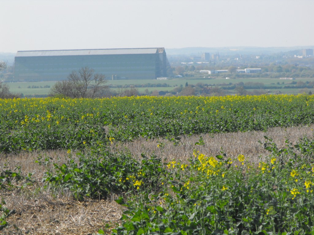 004. Taken from the hill that Old Warden tunnel runs under showing the giant airship hangers that dominate the landscape in this area. Photo: Dave Brewerton |
Old Warden tunnel north portal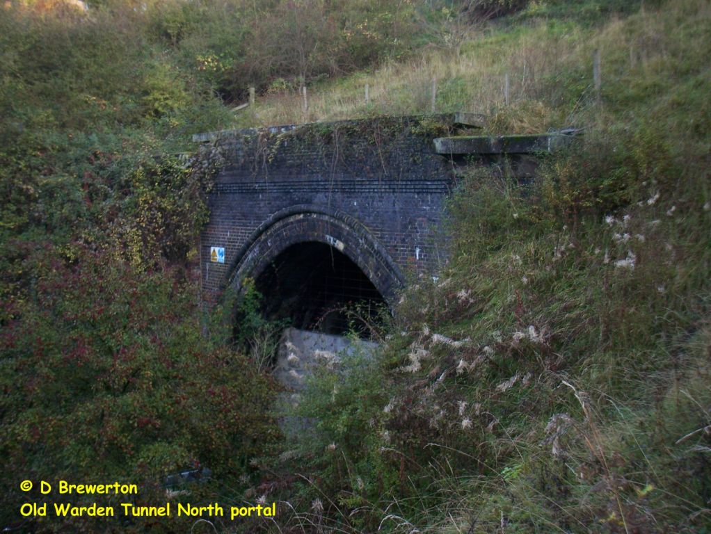 005. View through the north portal seems to show that the tunnel itself is in fair condition. Photo: Dave Brewerton |
|
Old Warden tunnel north cutting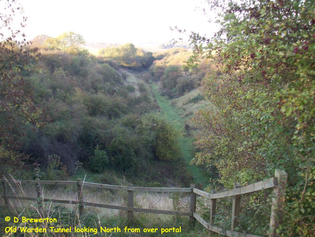 006. On the surface the tunnel is clearly marked by a wide avenue of trees that continues along the cutting north of the tunnel. Photo: Dave Brewerton |
Old Warden north cutting occupied by gas grid installation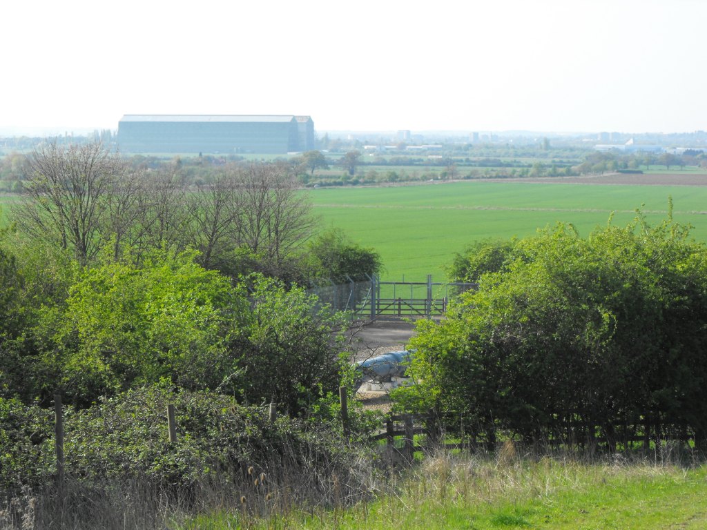 007. At the end of this cutting is, unfortunately, an above-ground high pressure gas installation, part of the National Gas Transmission System (grid). Photo: Dave Brewerton |
|
A clear run for 2 miles south of Cardington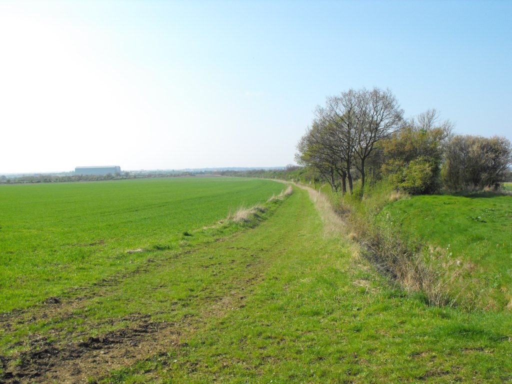 008. North from the NTS installation the route runs through open country to Cardington. Photo: Dave Brewerton |
Road overbridge near Cardington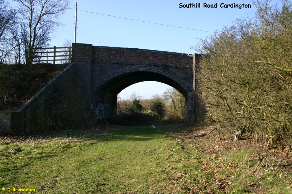 011. On this alignment there are embankments and two bridges in fairly good condition. Photo: Dave Brewerton |
|
From same bridge towards Old Warden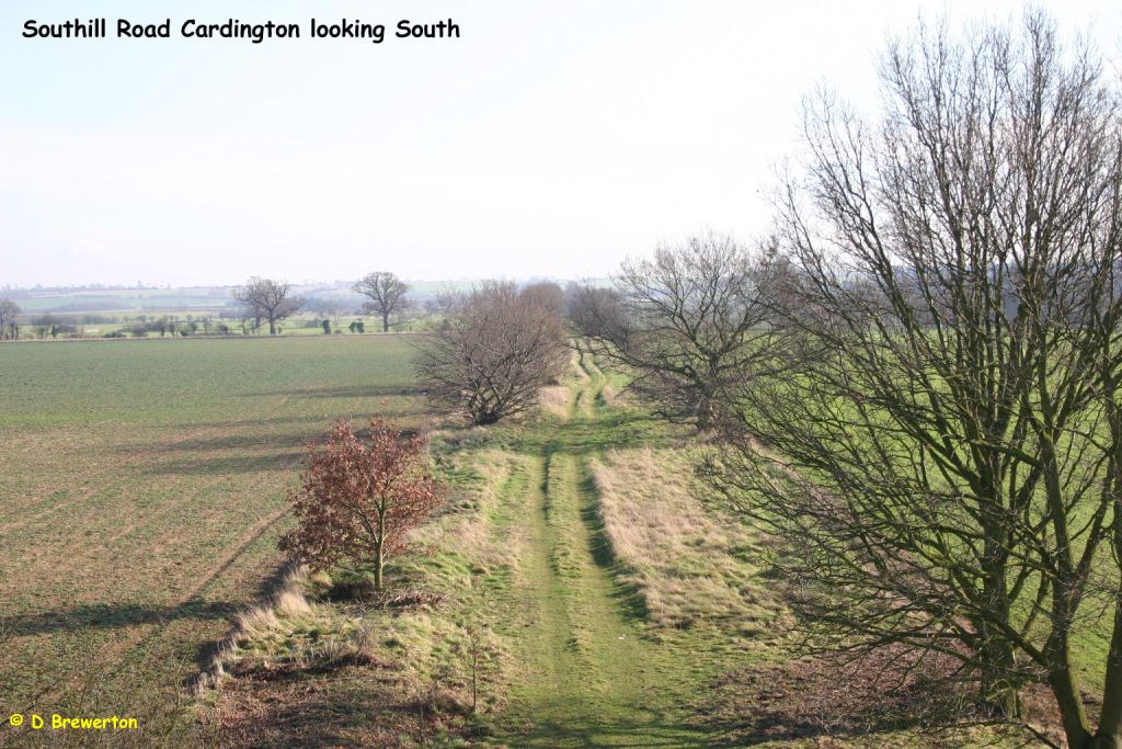 013. North from the NTS installation the route runs through open country to Cardington. Photo: Dave Brewerton |
Near Cardington looking south to Greensands Ridge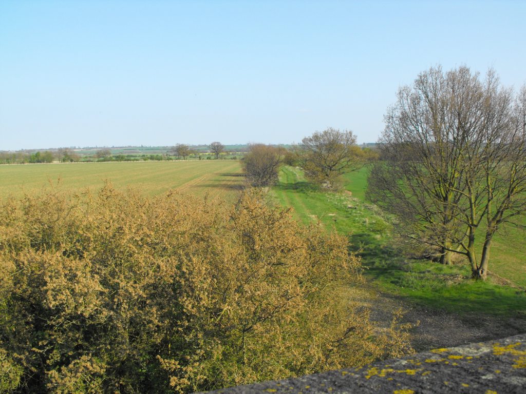 014. North from the NTS installation the route runs through open country to Cardington. Photo: Dave Brewerton |
|
Bedford south - the route runs close to modern industry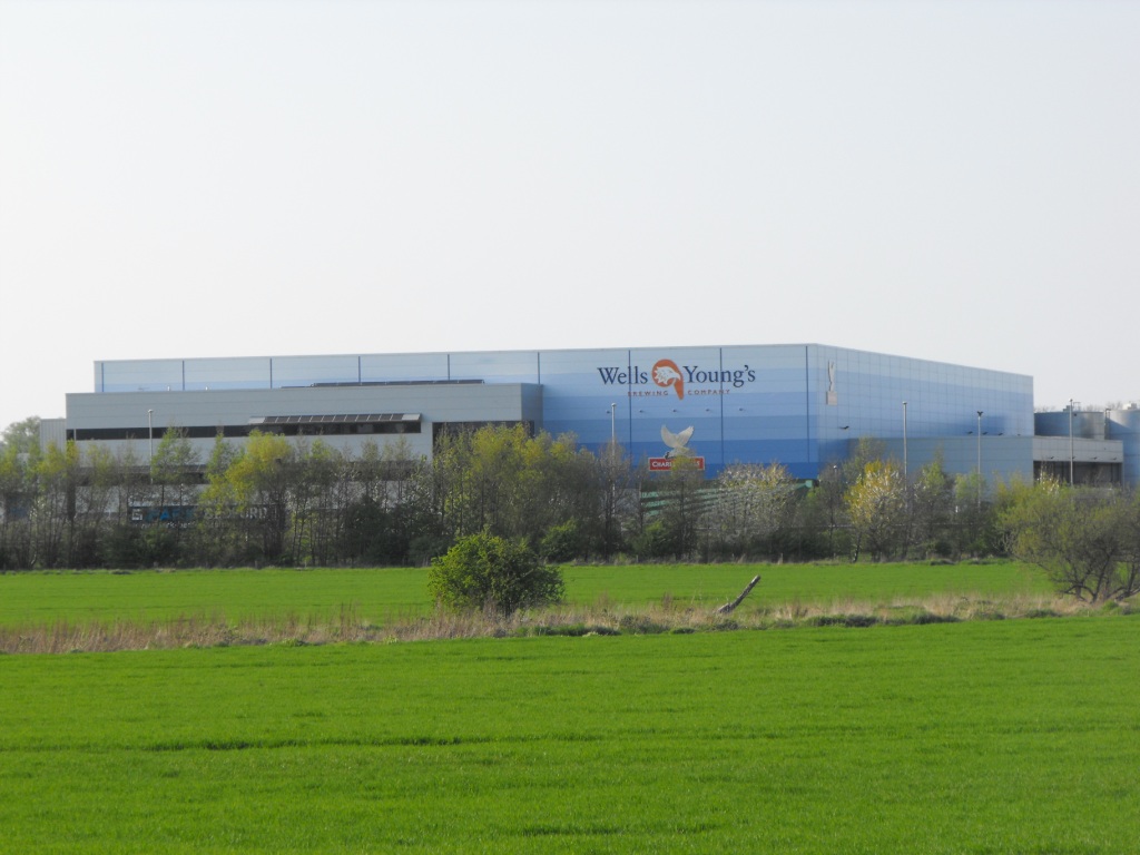 022. The route is interrupted by new development and the A421. Photo: Dave Brewerton |
A new route could run west to the Midland mainline near Elstow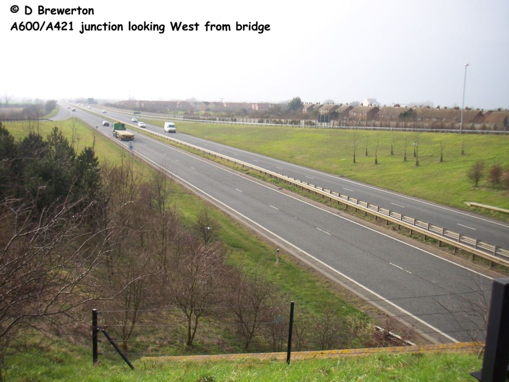 025. The A421 in the direction of the park-and-ride and Midland mainline, about 2 miles away. Photo: Dave Brewerton |
|
Photo Set 3 - Central Section - Other Photos |
||
The existing Bedford to Hitchin trackbed between Old Warden and the A421 Bedford southern by-pass |
||
Photos taken from 2006 to 2009. |
||
Abbey Farm nr south portal Old Warden tunnel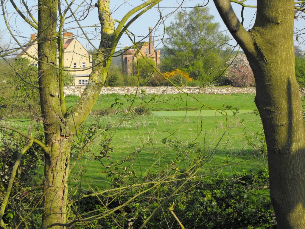 001. Southern approach to Old Warden tunnel including an interesting Victorian folly glimpsed through the trees a few hundred metres from the trackbed. Photo: Dave Brewerton |
Old Warden tunnel - south cutting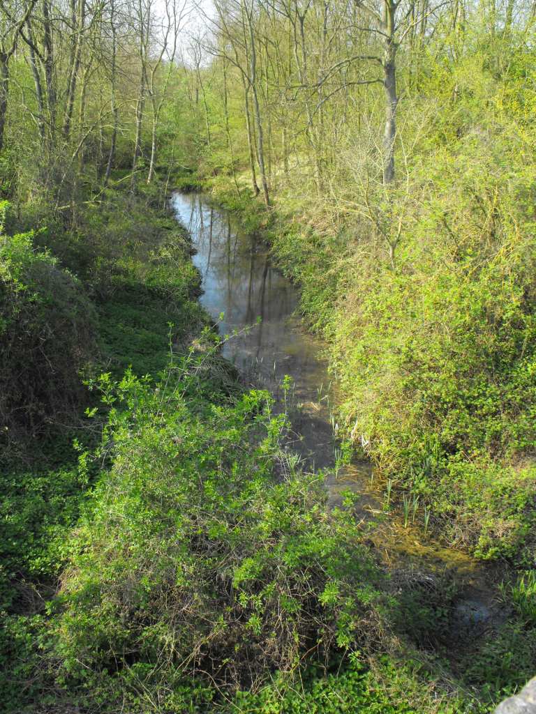 002. Southern approach to Old Warden tunnel including an interesting Victorian folly glimpsed through the trees a few hundred metres from the trackbed. Photo: Dave Brewerton |
|
Greensand Ridge - line of trees mark Old Warden tunnel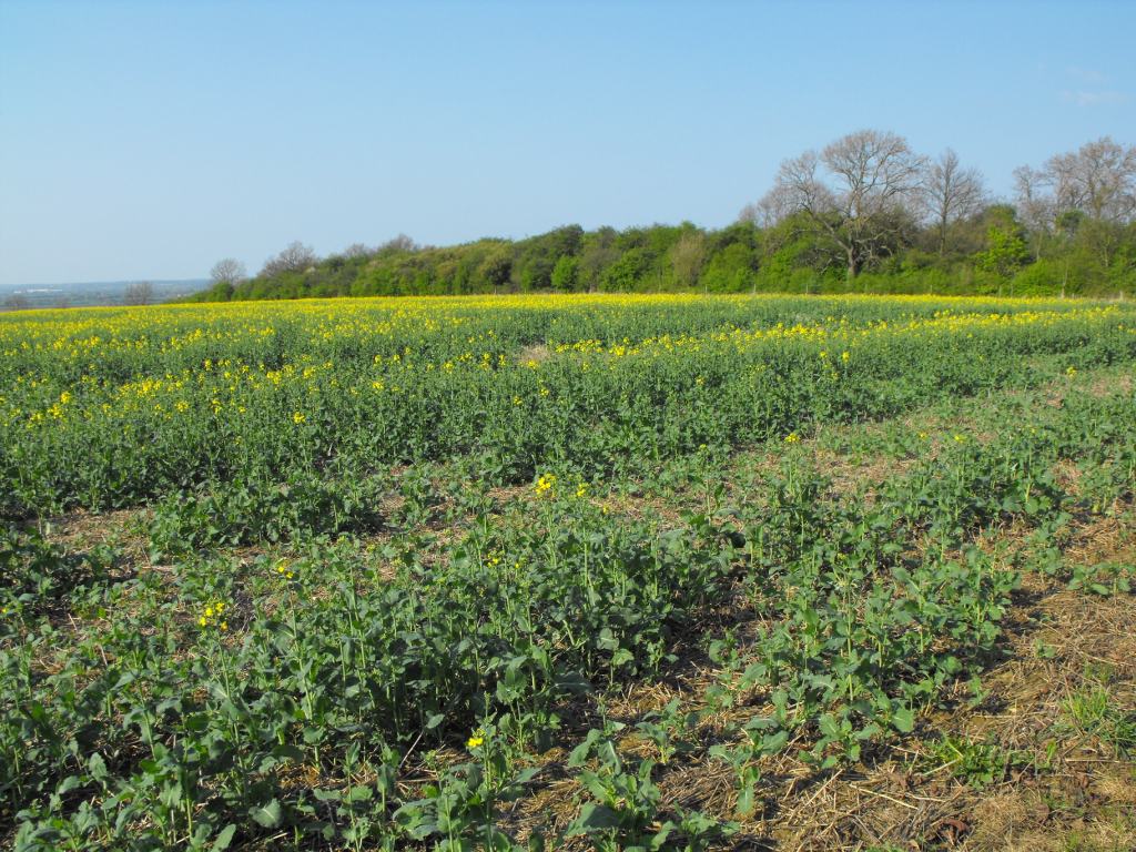 003. Taken from the hill that Old Warden tunnel runs under. Photo: Dave Brewerton |
Missing bridge nr Cardington could be easily replaced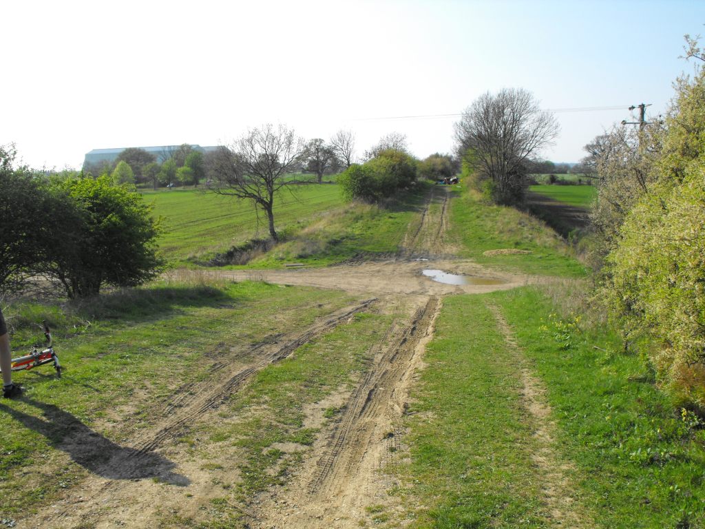 009. North from the NTS installation the route runs through open country to Cardington. Photo: Dave Brewerton |
|
Embankment near Cardington in good condition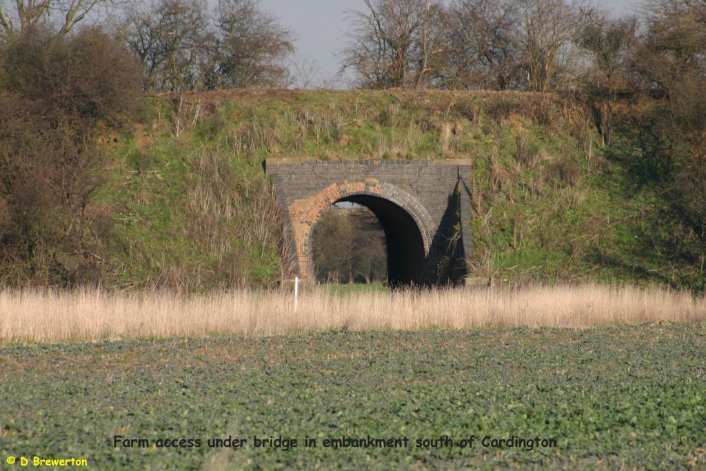 010. Embankment and bridge in fairly good condition. Photo: Dave Brewerton |
From overbridge towards Cardington and Bedford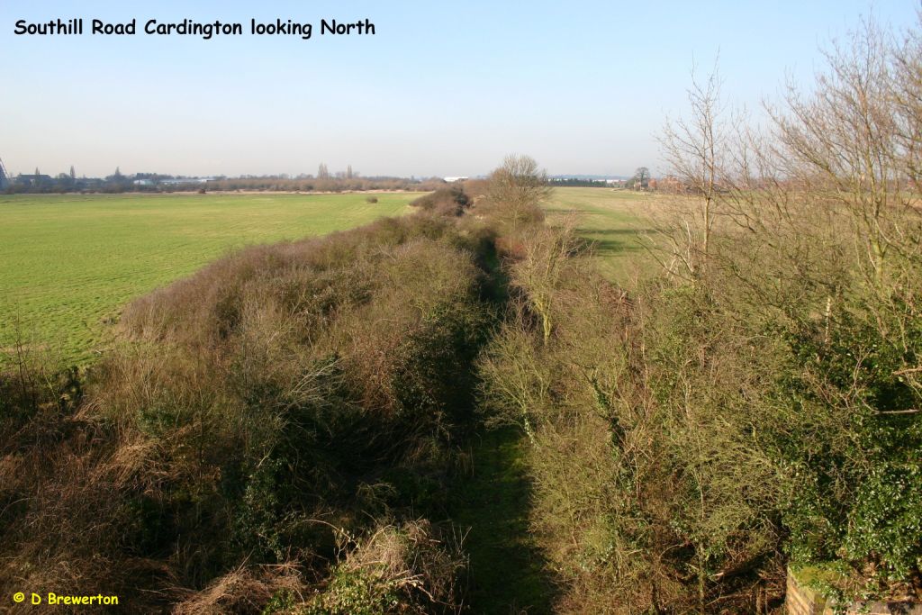 012. North from the NTS installation the route runs through open country to Cardington. Photo: Dave Brewerton |
|
Closest approach to Cardington (trackbed just behind camera)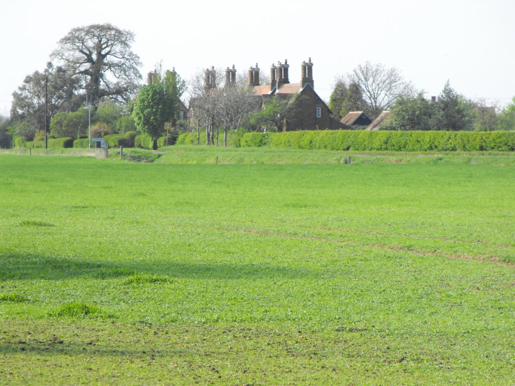 015. Half a mile west of Cardington � a small but prosperous village. Photo: Dave Brewerton |
Overbridge in fair condition 016. Another embankment and bridge in fairly good condition. Photo: Dave Brewerton |
|
Cardington church and village from the route 017. Half a mile west of Cardington � a small but prosperous village. Photo: Dave Brewerton |
The DSA Shortstown is adjacent to the route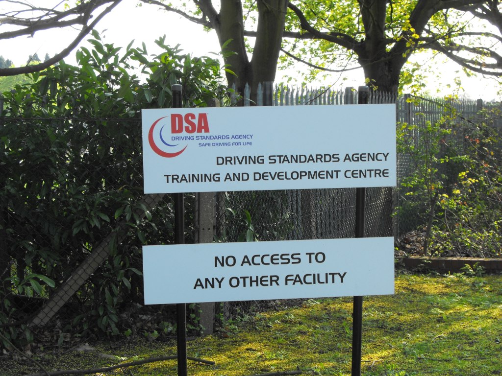 018. Close to the extensive Driving Standards Agency. Photo: Dave Brewerton |
|
Overgrown section north of Cardington 019. Route continues north towards Bedford. Photo: Dave Brewerton |
Between Cardington and A421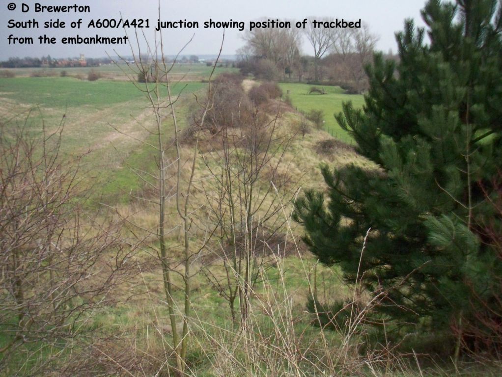 020. Route continues north towards Bedford. Photo: Dave Brewerton |
|
North of Cardington approaching the A421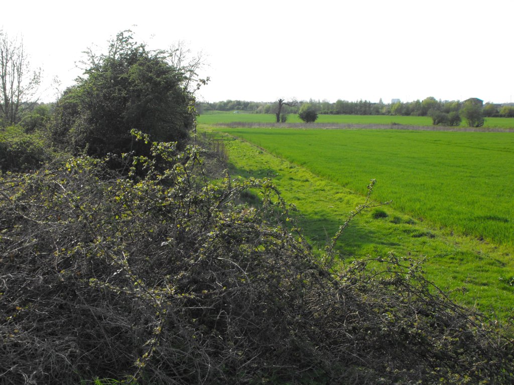 021. Route continues north towards Bedford. Photo: Dave Brewerton |
Route approaching the south side of A421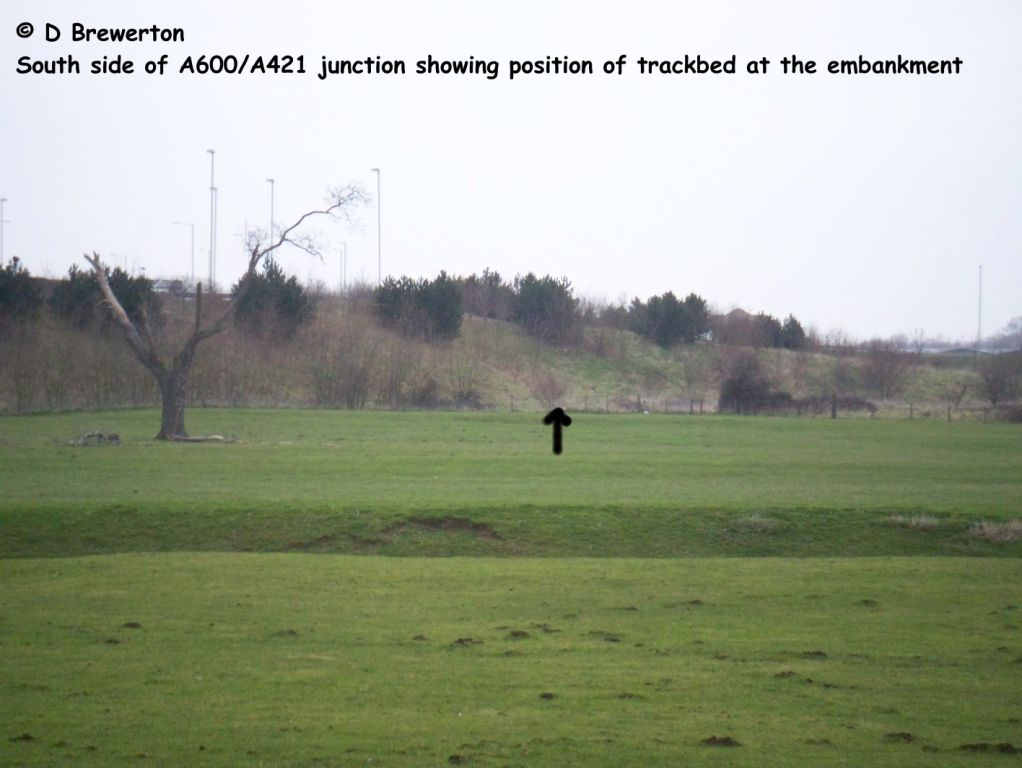 023. Route is interrupted by new development and the A421. Photo: Dave Brewerton |
|
A421 junction A 600 - trackbed to the right (out of shot)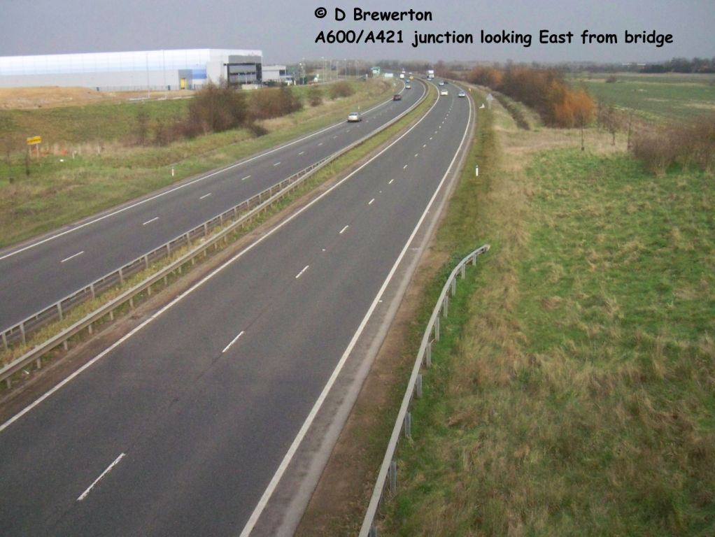 024. Route is interrupted by new development and the A421. Photo: Dave Brewerton |
||
Photo Set 4 - Western Section - Bedford and Bletchley main line stations |
||
Photos taken in March 2010. |
||
Bedford station bay platform for EWRL trains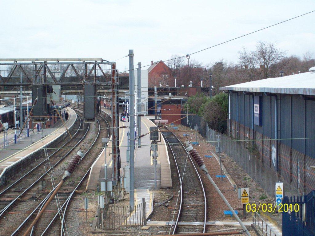 001. Bedford station from south showing empty bay platform 1a used by Marston Vale trains. Photo: Peter Wakefield |
Bedford station bay platform for EWRL trains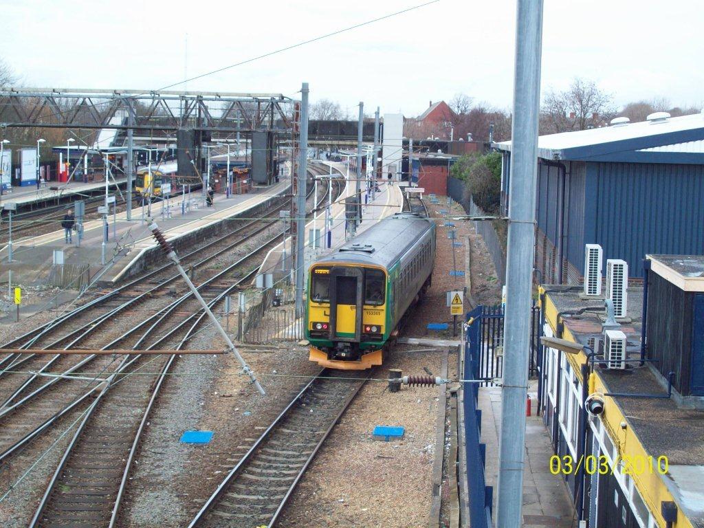 002. Bedford station from south showing Marston Vale Class 153 train for Bletchley leaving from bay platform 1a. Photo: Peter Wakefield |
|
Bedford station bay platform for EWRL trains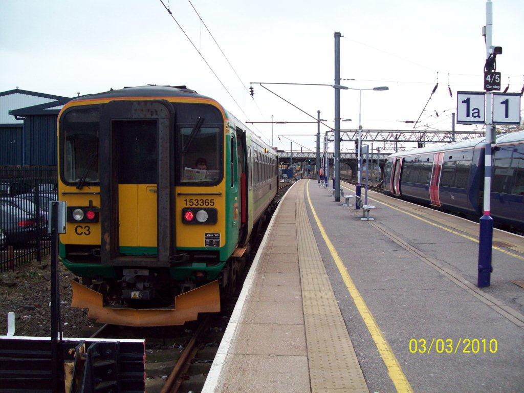 003. Bedford station from south showing Marston Vale class 153 train waiting in bay platform 1a. Photo: Peter Wakefield |
Bletchley flyover to be used by EWRL trains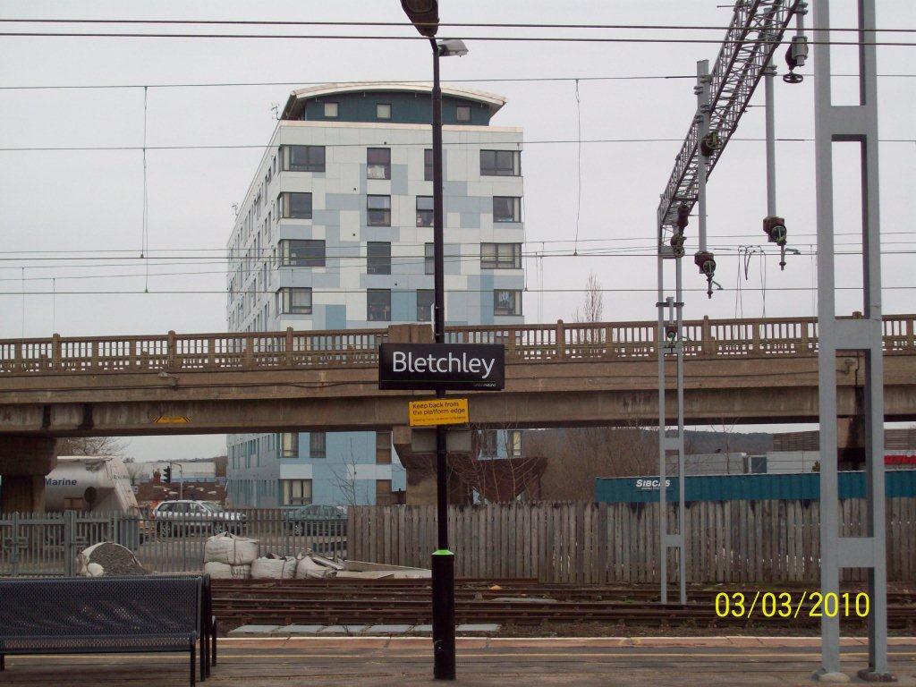 004. Bletchley flyover towards Oxford looking eastwards from platform. Photo: Peter Wakefield |
|
Bletchley flyover to be used by EWRL trains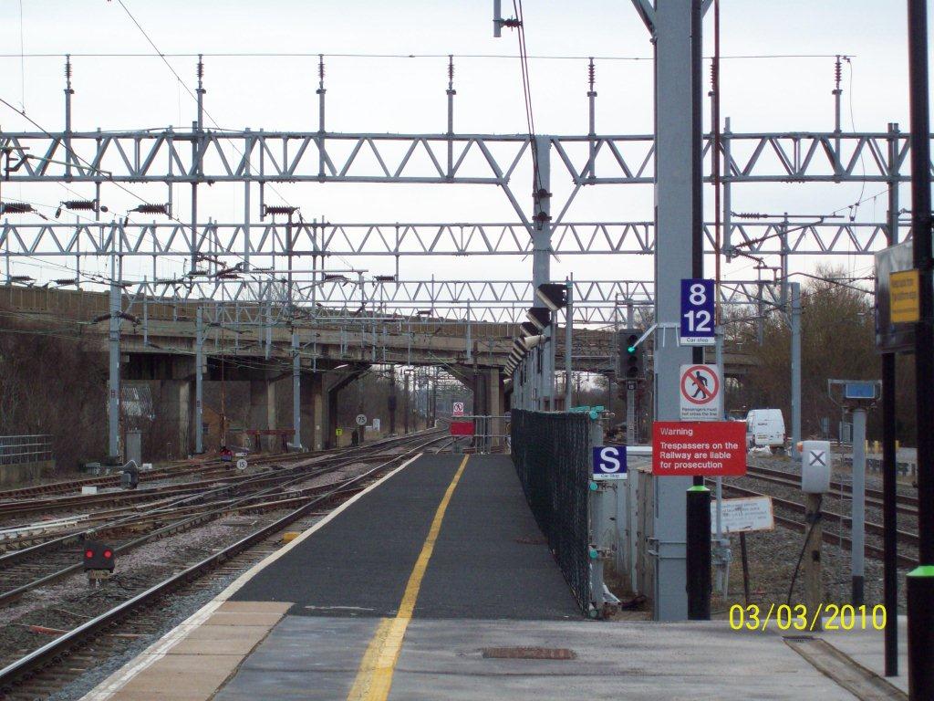 005. Bletchley flyover towards Oxford looking southwards from platform. Photo: Peter Wakefield |
Bletchley flyover to be used by EWRL trains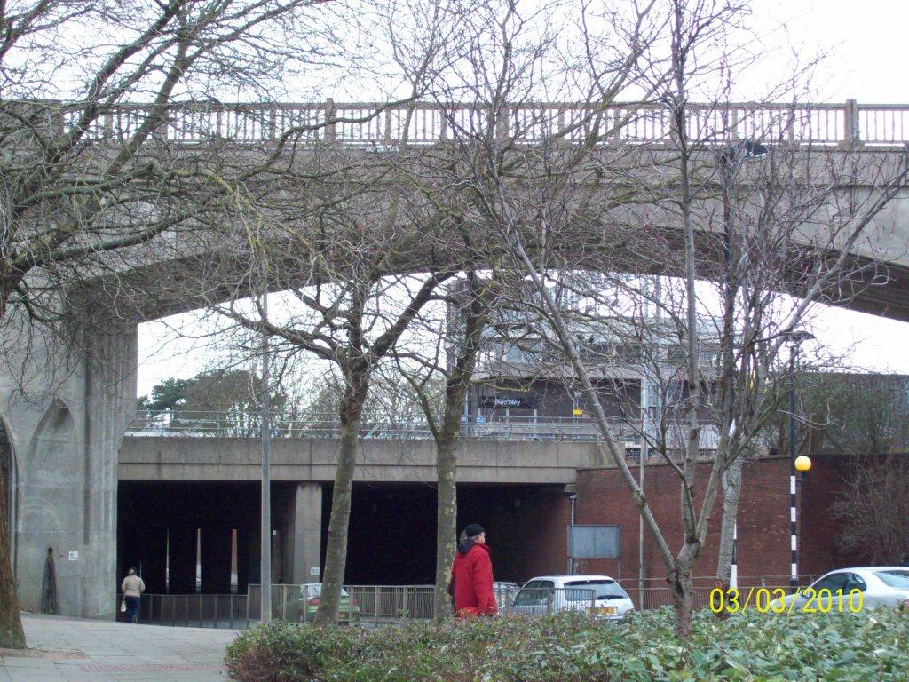 006. Bletchley flyover upper - Oxford to right. WCML lower bridge - London to right. Photo: Peter Wakefield |
|
Bletchley flyover to be used by EWRL trains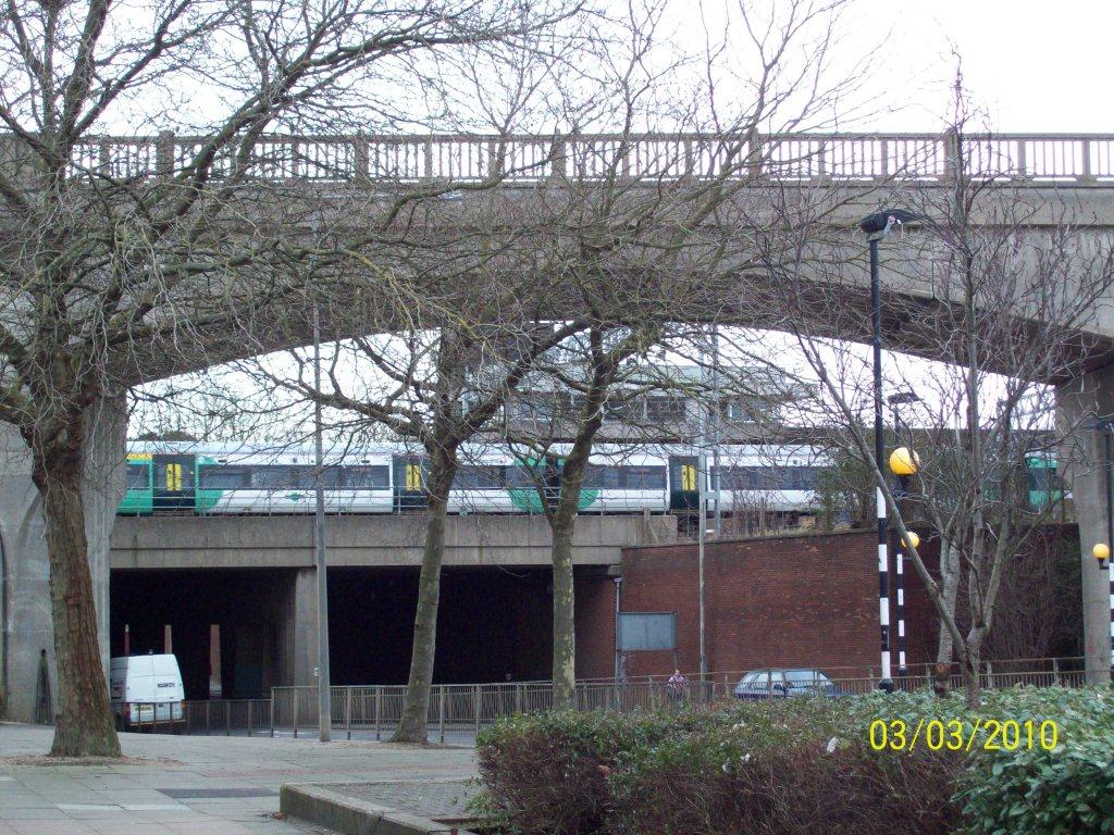 007. Bletchley flyover as train goes travels above road underpass. Photo: Peter Wakefield |
||
Photo Set 5 - Western Section Phase 1 - Evergreen 3 project |
||
Photos taken in Feb/March 2013. |
||
Evergreen 3: Islip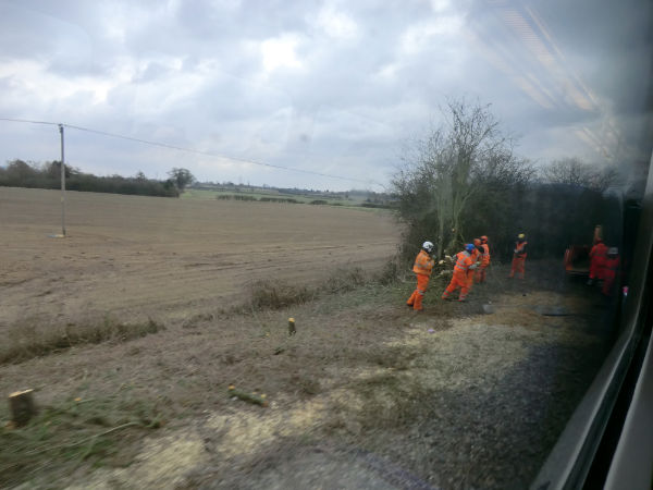 001. Network Rail contractors cutting undergrowth south of Islip. (23 Feb 2013) Photo: John Elvin |
Evergreen 3: Water Eaton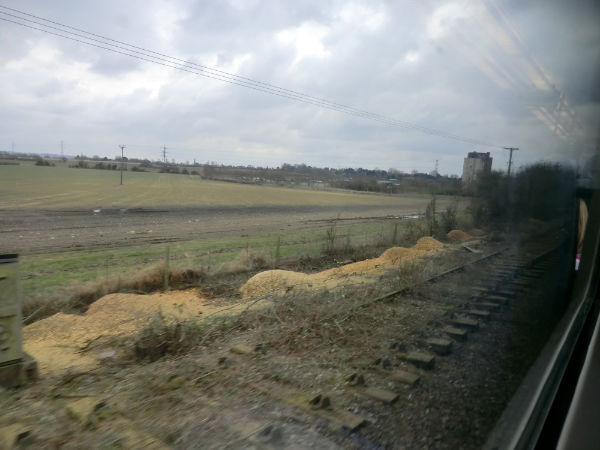 002. Approaching Water Eaton aggregates sidings and site of proposed new station. (23 Feb 2013) Photo: John Elvin |
|
Evergreen 3: Langford Crossing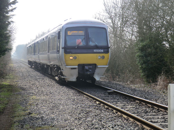 003. 13:30 Oxford to Bicester Town approaching Langford Crossing showing cleared 2nd trackbed on left. (23 Feb 2013) Photo: John Elvin |
Evergreen 3: Bicester-Islip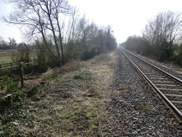 004. Cleared 2nd trackbed between Bicester and Islip, facing south. (6 Mar 2013) Photo: John Elvin |
|
Evergreen 3: Bicester-Islip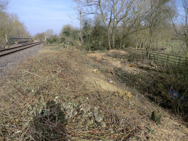 005. Cleared 2nd trackbed & embankment between Bicester and Islip, facing north. (6 Mar 2013) Photo: John Elvin |
||
Photo Set 6 - Central Section - Joint Railfuture and CBT Ox-Cam Walk |
||
Photos taken June 2013. |
||
|
Ox-Cam Rally Starts 001. Phil Smart, Ipswich BC Portfolio Holder Environment & Transport (foreground, right) leads the rally. |
Political Support 002. Iain Stewart, MP for MK South (left) and CfBT Chief Exec Stephen Joseph (right). |
|
|
Local Politician 003. Peter Wakefield Railfuture Regional Chairman chats to Councillor Kristy Adams Bedford Boro Council. |
Destination Reached 004. Safe arrival in Sandy |
|
Photo Set 7 - Central Section - Cambridge-Bedford route |
||
Along route of possible railway between Bedford and Cambridge |
||
Photos taken in 2015/16. |
||
Railway line and busway from Cambridge - view to SSW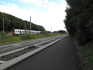 001. CAMBRIDGE TO BEDFORD. The main line to London, half a mile south from Cambridge. All route options run on this line. |
Railway line at Little Shelford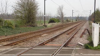 002. CAMBRIDGE TO BEDFORD. The new route to Bedford could diverge to the west here. |
|
M11 at Little Shelford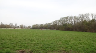 003. CAMBRIDGE TO BEDFORD. M11 runs on the embankment on right; a short tunnel needed here. |
M11 west side near Granchester - view to north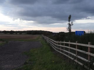 004. CAMBRIDGE TO BEDFORD. M11 corridor near Granchester. M11 in a shallow cutting here. |
|
Bourn Airfield from A428 - view to ESE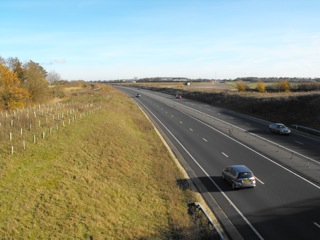 005. CAMBRIDGE TO BEDFORD. A428 with Bourn Airfield beyond the far carriageway. A major housing development is planned on the airfield. |
A428 near Cambourne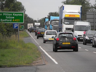 006. CAMBRIDGE TO BEDFORD. Eastbound queue in the morning peak is often 5 miles long. |
|
A428 near ECML - view to SW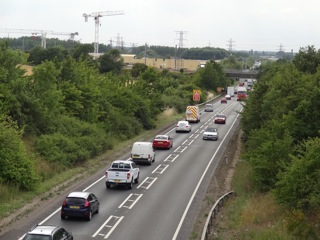 007. CAMBRIDGE TO BEDFORD. Westbound queue in the evenings is often 2 miles long. |
X5 Bus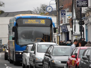 008. CAMBRIDGE TO BEDFORD. X5 Cambridge to Milton Keynes and Oxford is heavily delayed by traffic and at peak periods is too full to pick-up en route. |
|
Loves Farm South Cambs - view to NW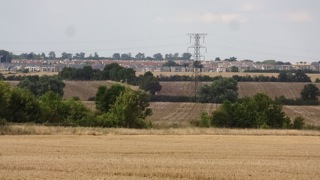 009. CAMBRIDGE TO BEDFORD. Loves Farm estate is close to St Neots station but causes congestion on the A428. |
A421 at junction with A1 - view to East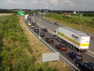 010. CAMBRIDGE TO BEDFORD. Evening peak queue with most of the traffic turning left for St Neots, Huntingdon and Cambridge. |
|
BlackCat road project - view to WSW 011. CAMBRIDGE TO BEDFORD. Previous photo queue has been relieved by junction widening and signals - but for how long? New junction has passive provision for new road towards Cambridge. |
Green Sand Ridge - view to SE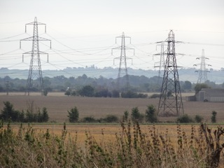 012. CAMBRIDGE TO BEDFORD. Taken from St Neots - Sandy area, east of ECML. EW route either runs on the flat country towards Cambourne, or cuts through the ridge in the distance. |
|
Little Barford and ECML - view to NE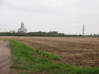 013. CAMBRIDGE TO BEDFORD. Potential site for junction of East West Rail with ECML which is visible centre right. |
Mullard dishes - view to East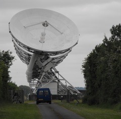 014. CAMBRIDGE TO BEDFORD. Mullard dishes traverse a section of the old railway line. |
|
Mullard RAO - view to West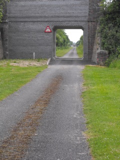 015. CAMBRIDGE TO BEDFORD. Mullard radio astronomy observatory. |
Gamlingay and Sandy - view to West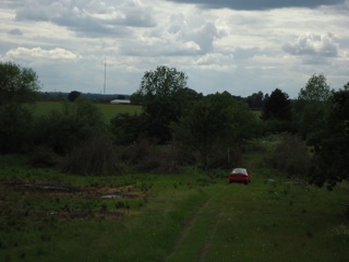 016. CAMBRIDGE TO BEDFORD. Car is driving towards Oxford on the old route! Sandy Heath TV transmitter on left horizon. |
|
Countryside Sandy to Biggleswade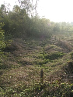 017. CAMBRIDGE TO BEDFORD. Much of the land in the area is owned by the Royal Society for Protection of Birds or is designated Ancient Common. |
A421 and River Valley Park - view to East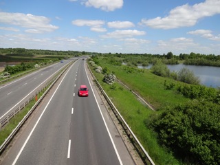 018. CAMBRIDGE TO BEDFORD. A route near to the original ,or south of it, will need to cross the A421 to reach Bedford station. The crossing design will need to avoid disturbance to the River Valley Park and that could mean tunnelling. |
|
Midland Main Line north Bedfordshire ridge - view to SE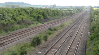 019. CAMBRIDGE TO BEDFORD. A route to the north of Bedford avoids the River Valley Park, and would use the MML to access Bedford station. The route will need to ascend the rolling hills to the north-east of the town. |
||
Photo Set 8 - Western Section - Oxford to Oxford Parkway being rebuilt |
||
Photos taken in summer 2016. |
||
East side of Oxford station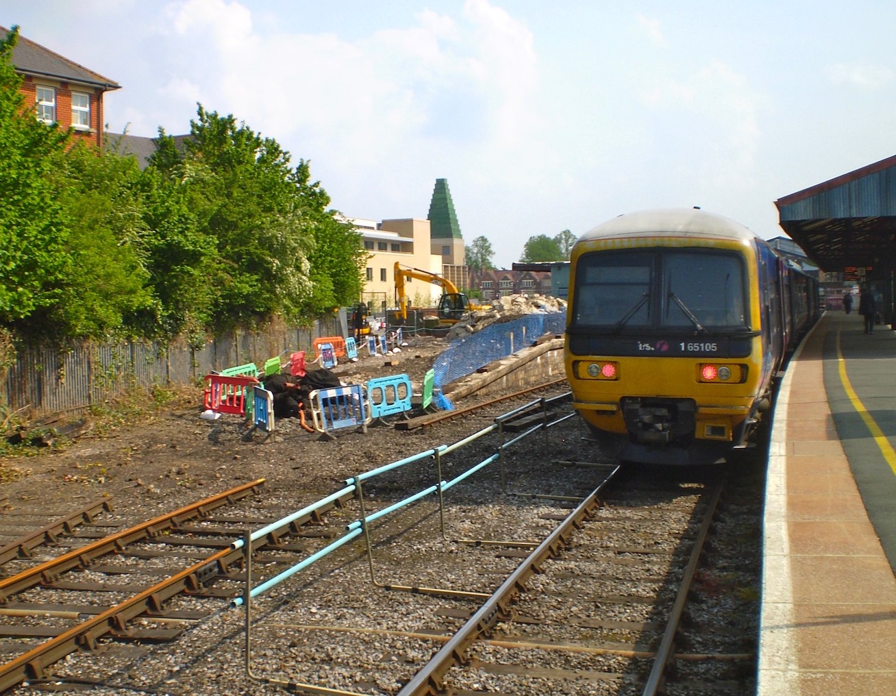 001. Clearing east side of Oxford Station (16 May 2016) Photo: Richard Stow |
East side of Oxford station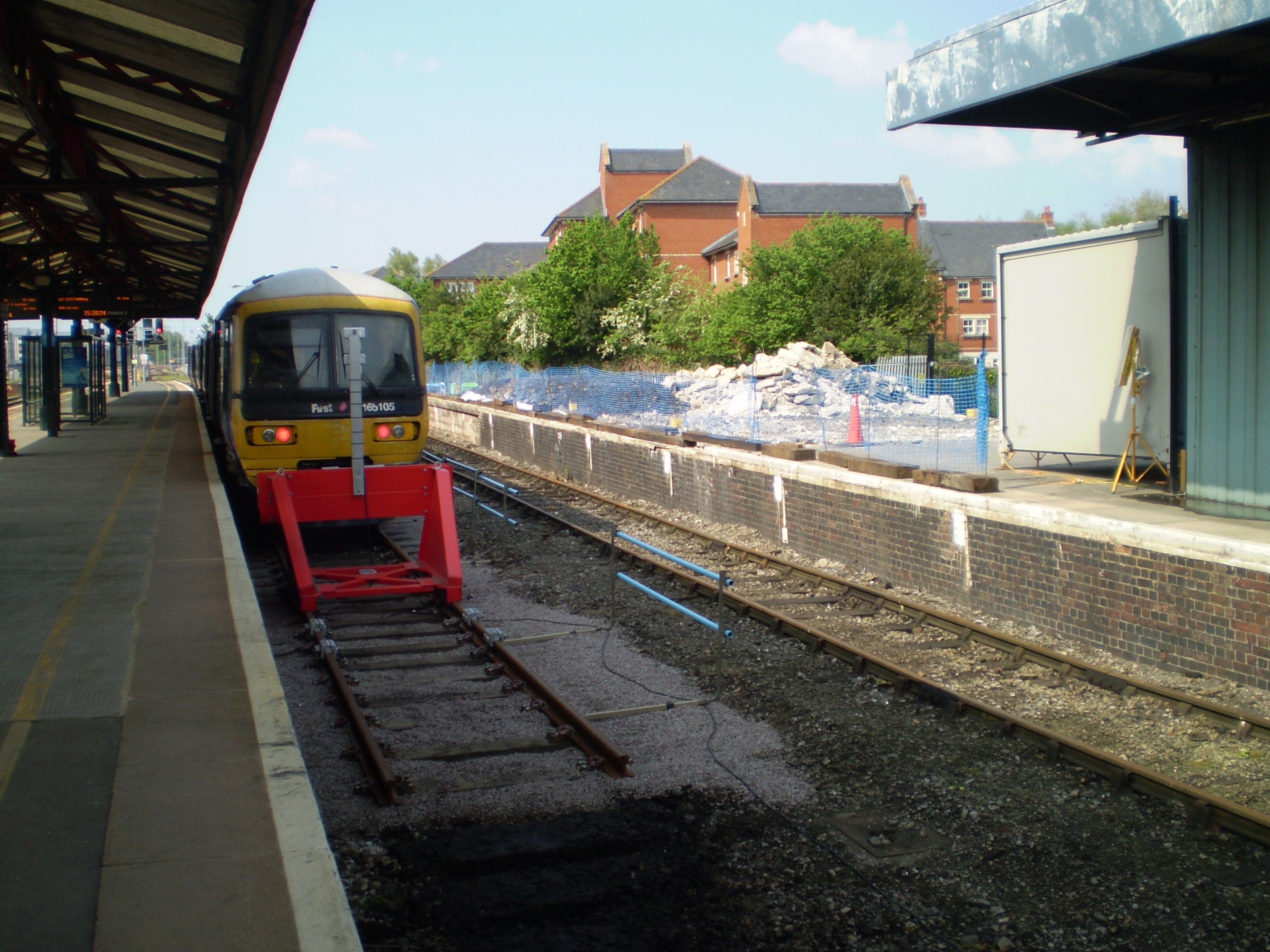 002. Clearing east side of Oxford Station (16 May 2016) Photo: Richard Stow |
|
Sheepwash channel north of Oxford station 003. Sheepwash channel north of Oxford shows the Jericho lines severed. (26 Jul 2016) Photo: Richard Stow |
Rebuilding cutting at Wolvercote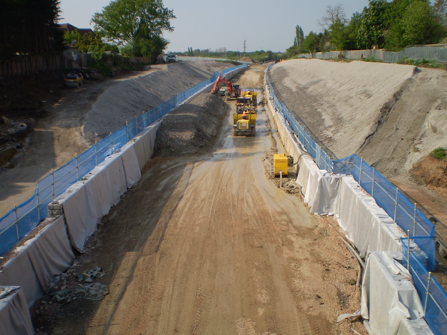 004. Rebuilding the cutting at Wolvercote (16 May 2016) Photo: Richard Stow |
|
Rebuilding trackbed at Wolvercote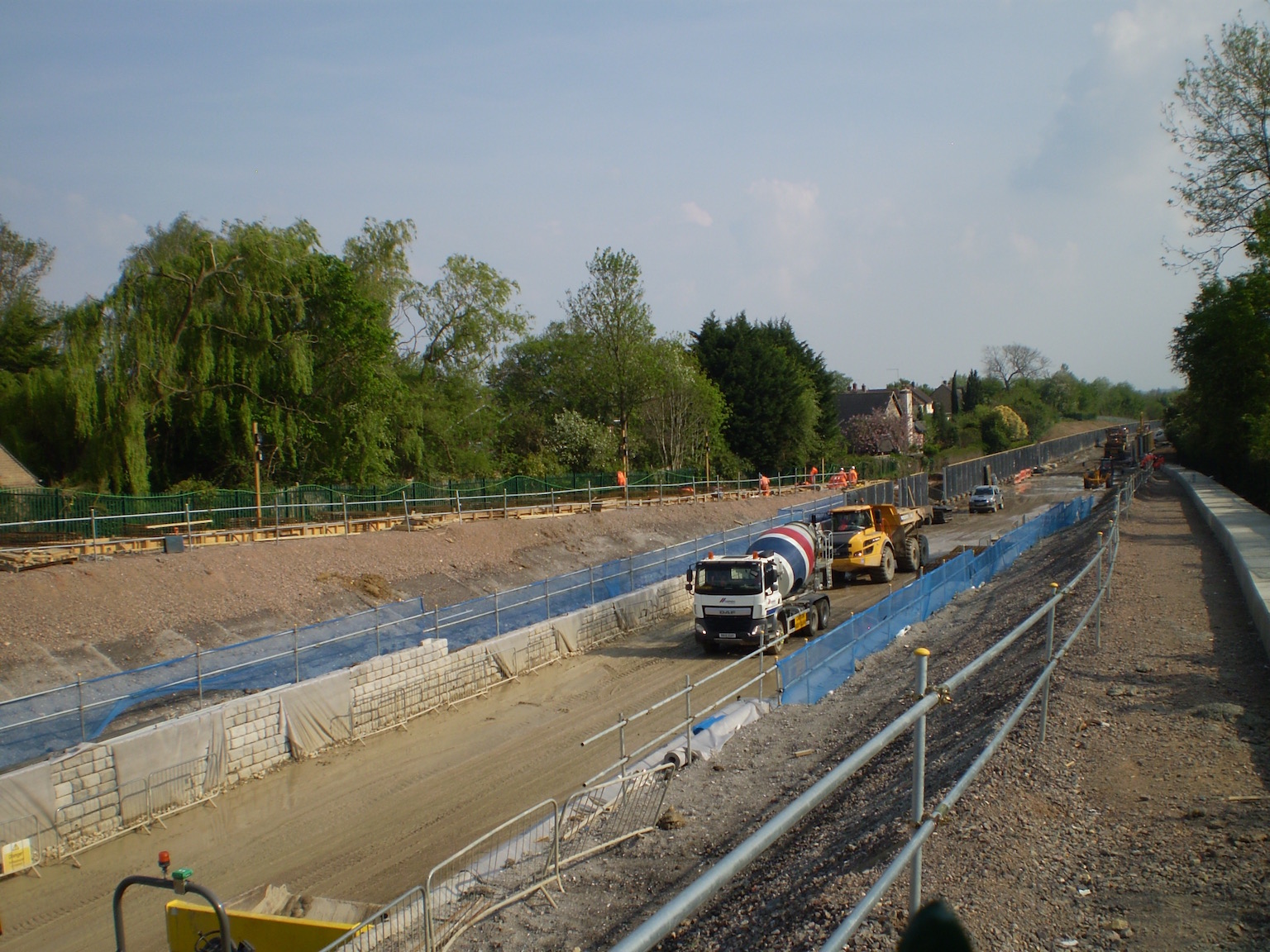 005. Rebuilding the trackbed at Wolvercote (16 May 2016) Photo: Richard Stow |
Rebuilding trackbed at Wolvercote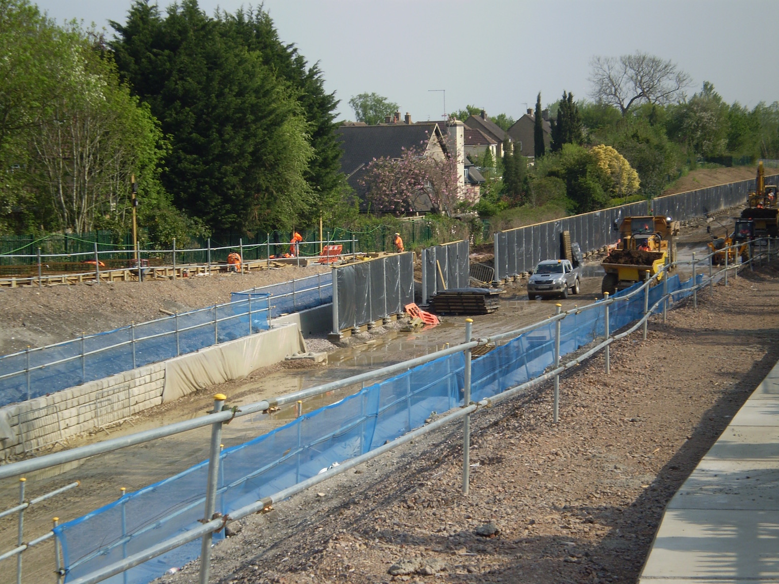 006. Rebuilding the trackbed at Wolvercote (16 May 2016) Photo: Richard Stow |
|
Rebuilding trackbed at Wolvercote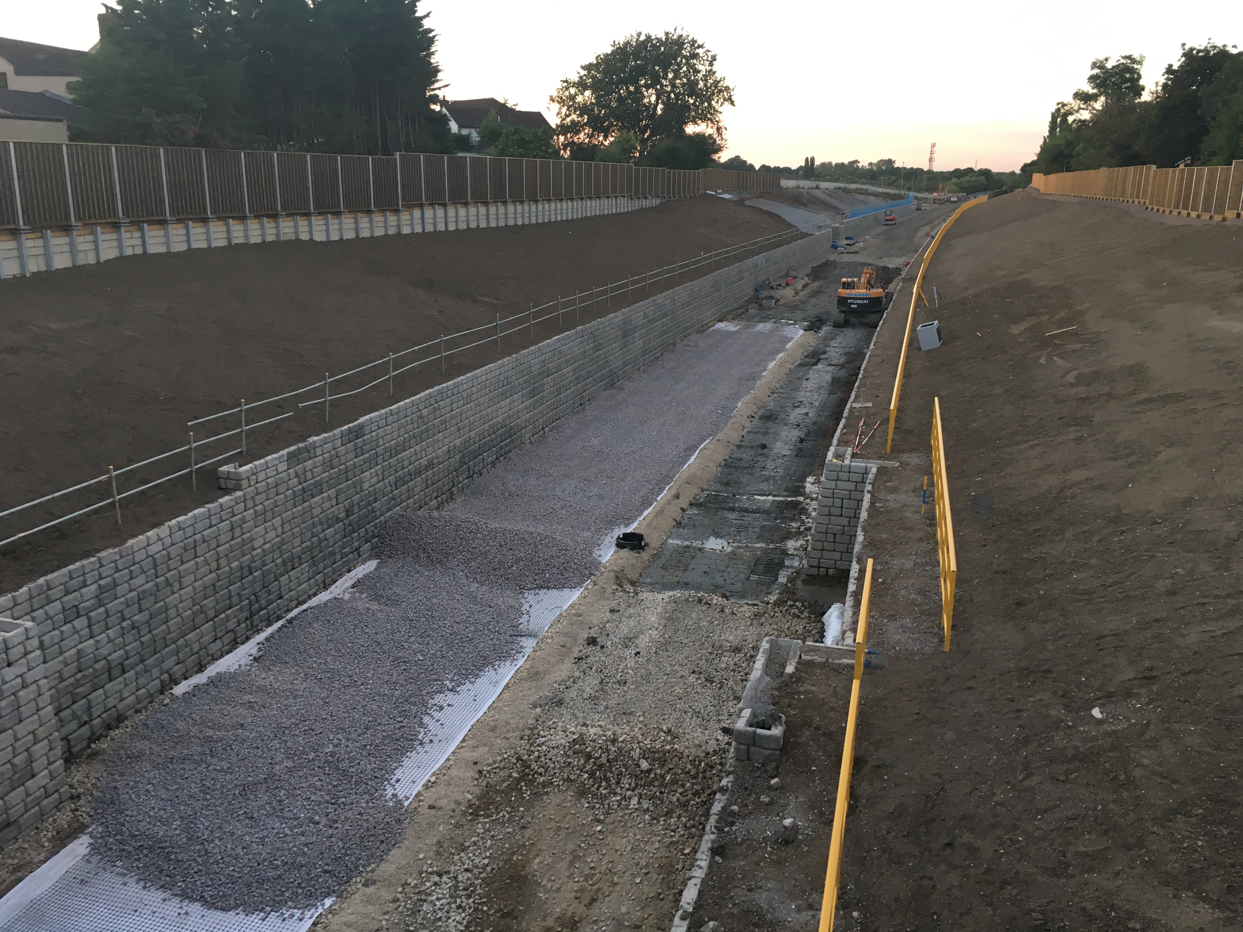 007. Track bed almost complete at Wolvercote (23 Aug 2016) Photo: Richard Stow |
Cutting and trackbed at Wolvercote tunnel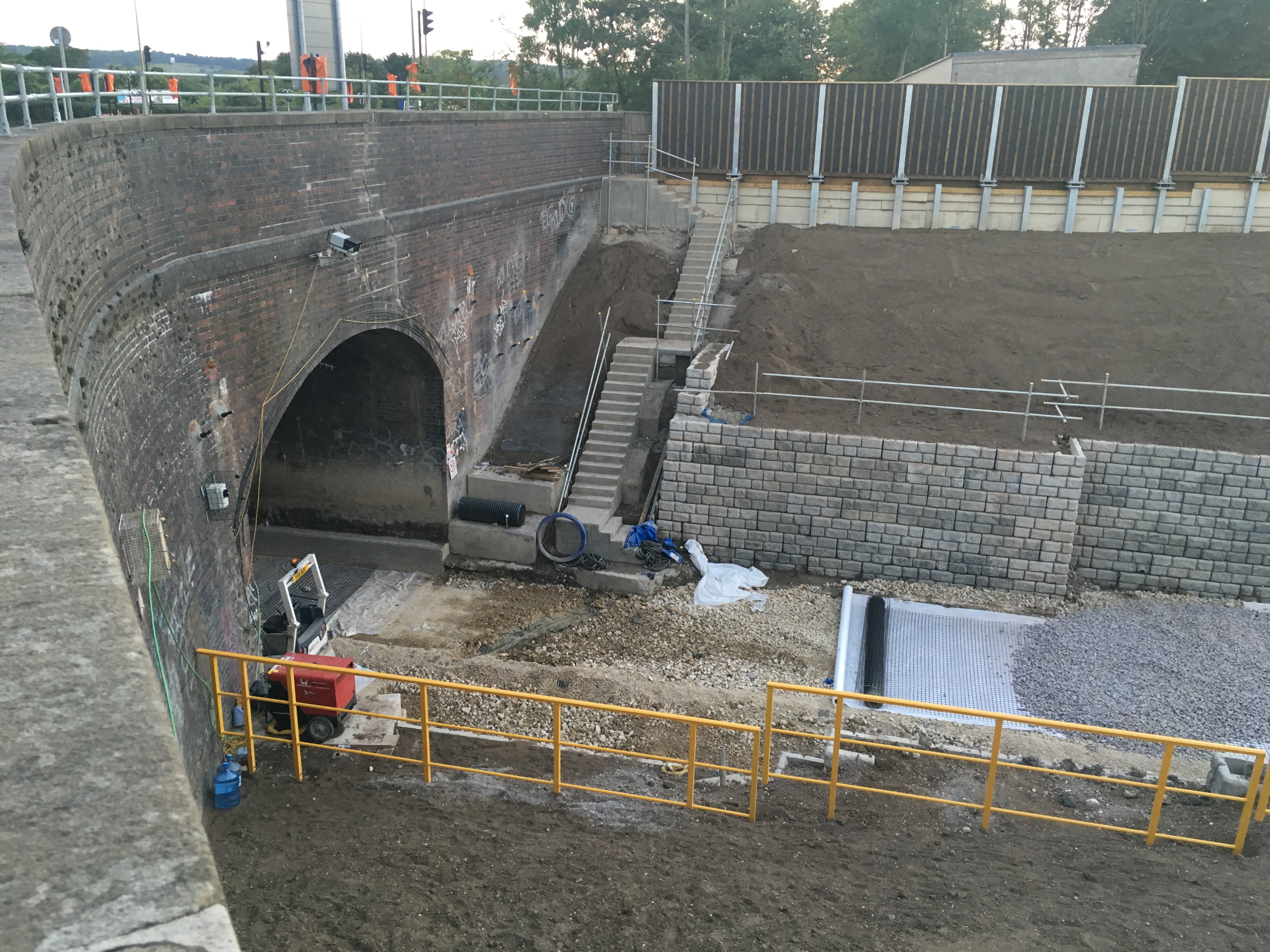 007. Cutting and trackbed at Wolvercote tunnel (23 Aug 2016) Photo: Richard Stow |
|
New track at Wolvercote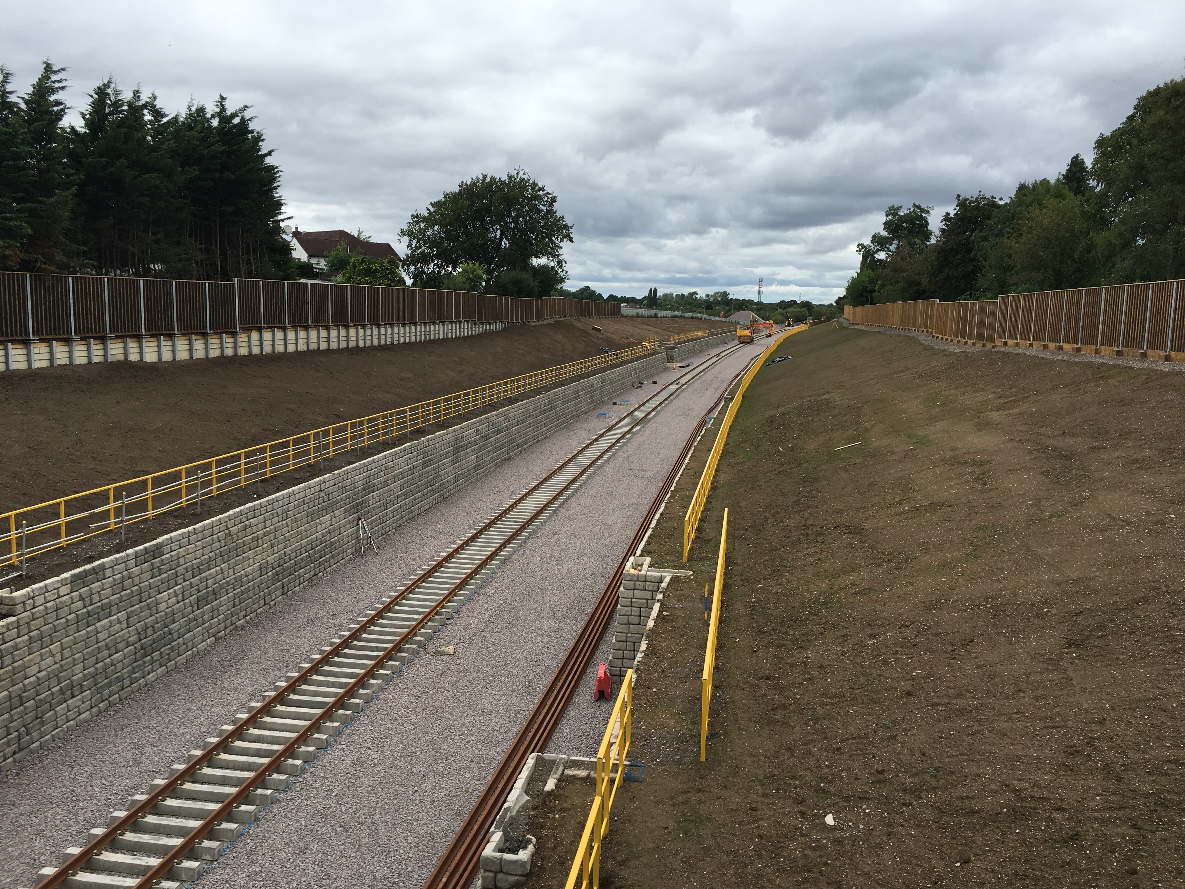 009. Unballasted track in place at Wolvercote (04 Sep 2016) Photo: Richard Stow |
||
Photo Set 9 - Western Section Phase 2 - Bicester to Bletchley being rebuilt |
||
Photos taken during 2020. |
||
| SWANBOURNE |
||
Swanbourne old rail in place with vegetation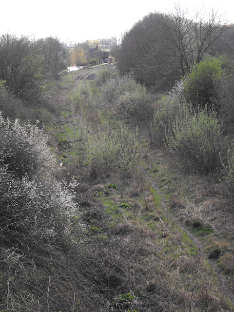 001. View from overbridge east towards Swanbourne station (March 2011) Photo: John Henderson |
Swanbourne station former platform 002. The EWR Alliance arrives at Swanbourne (April 2020) Photo: John Elvin |
|
Swanbourne old rail in place vegetation cleared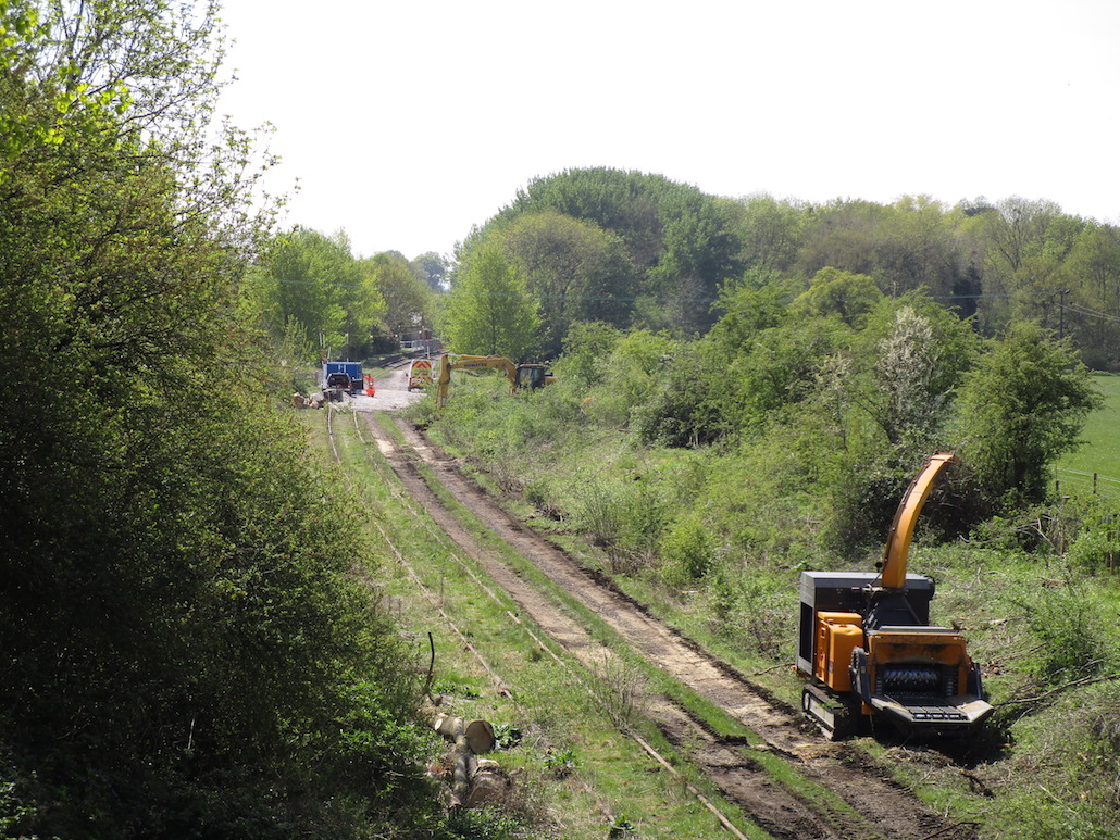 003. View from the overbridge east towards Swanbourne station (April 2020) Photo: John Elvin |
Swanbourne trackbed being rebuilt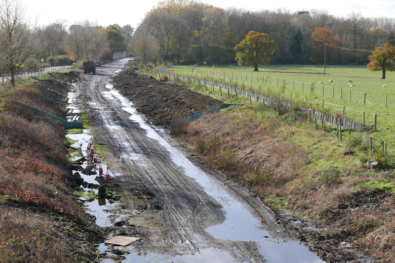 004. View from the overbridge east towards Swanbourne station (November 2020) Photo: John Henderson |
|
Swanbourne station demolition (started)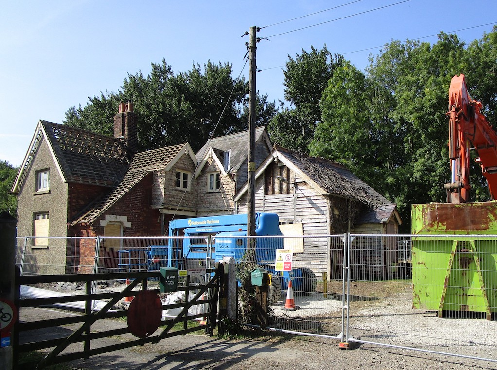 005. Swanbourne Station House in the course of demolition (19 September 2020) Photo: John Elvin |
Swanbourne station demolition (almost finished)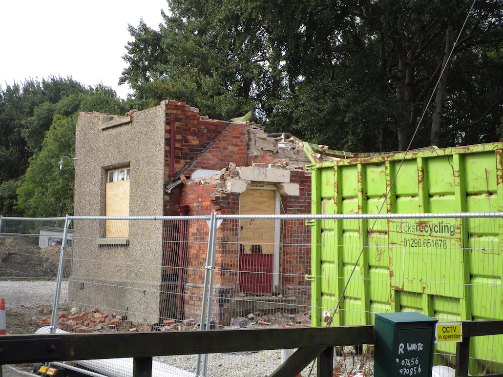 006. Swanbourne Station House part demolished (27 September 2020) Photo: John Elvin |
|
Swanbourne station build flattened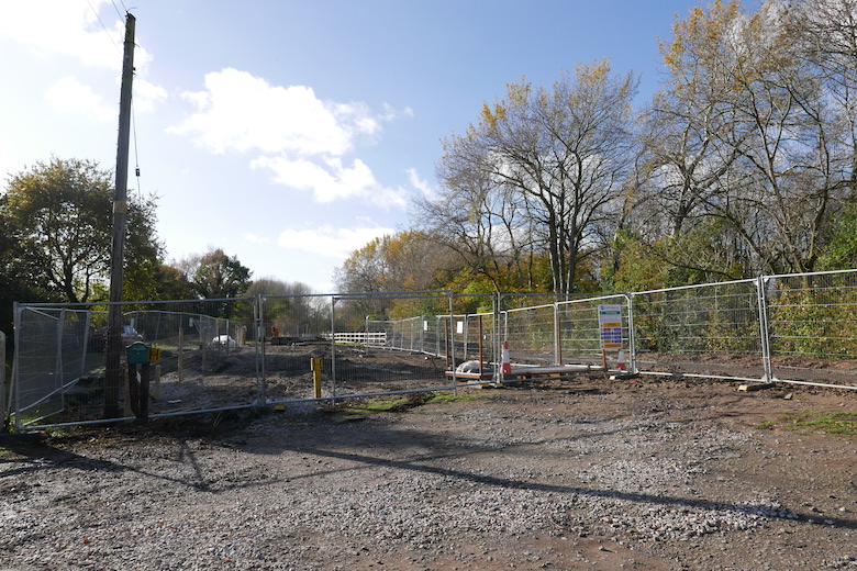 007. Swanbourne station area after demolition (November 2020) Photo: John Henderson |
||
| WINSLOW |
||
Winslow rail underbridge (1 of 2)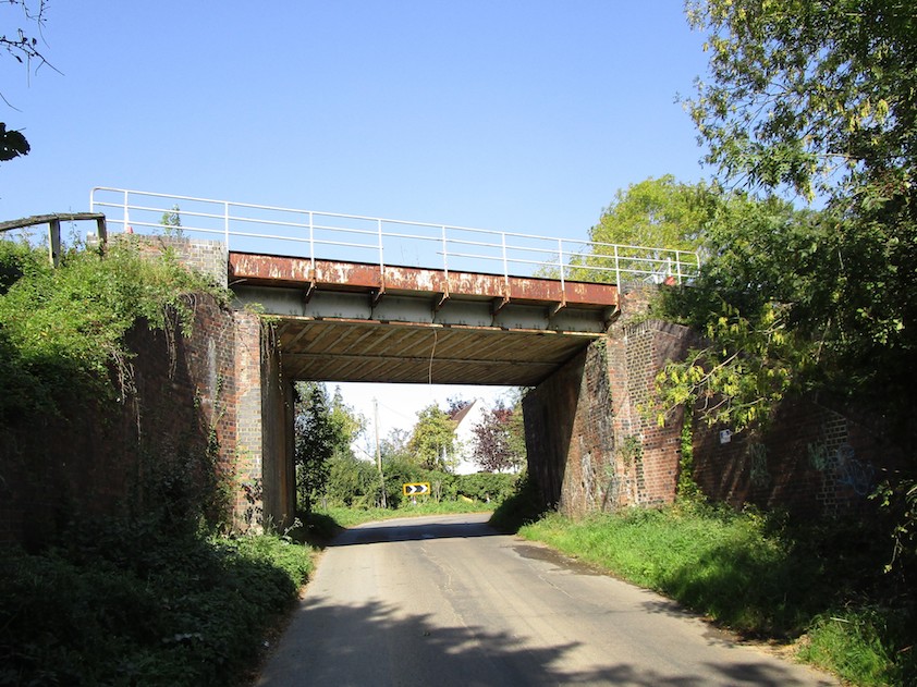 008. Winslow rail underbridge to east (September 2020) Photo: John Elvin |
Winslow rail underbridge (2 of 2)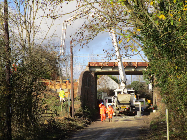 009.The bridge to east of Winslow with concrete being poured into new abutments (October 2020) Photo: John Elvin |
|
Winslow station site before cutting cleared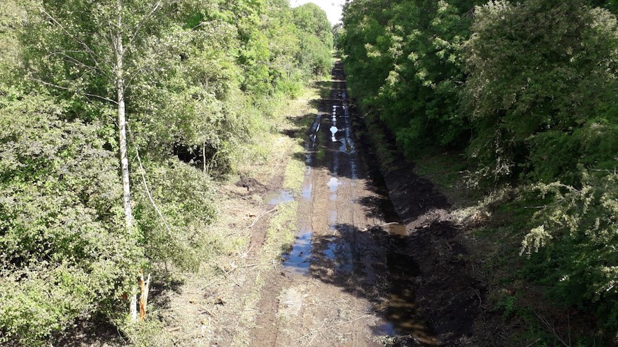 010. Winslow station site trees still line cutting walls (Spring 2020) Photo: John Elvin |
Winslow station site after cutting cleared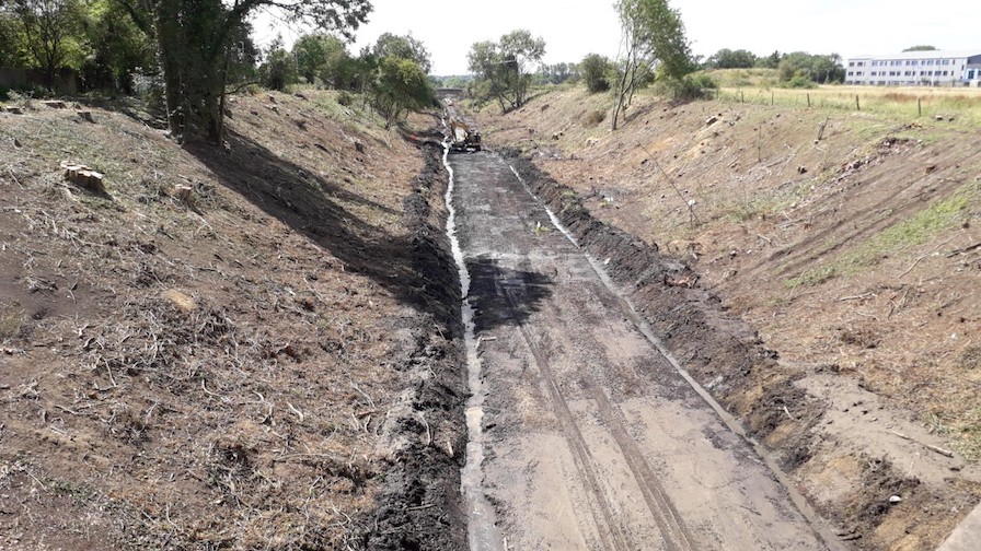 011. Winslow station site after cutting cleared of all trees (September 2020) Photo: John Elvin |
|
Winslow station site with large crane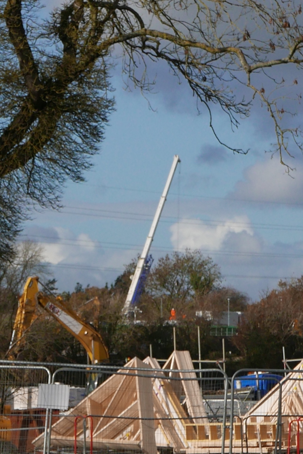 012. View towards Winslow station site with heavy lift in progress (November 2020) Photo: John Henderson |
||
| LAUNTON |
||
Launton level crossing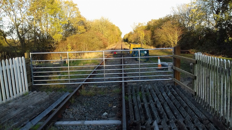 013. View to east from Launton level crossing near Bicester (November 2018) Photo: John Elvin |
East from Launton level crossing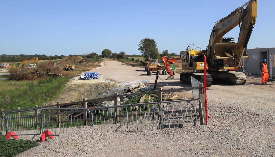 014. New bridge under construction east from Launton level crossing (September 2020) Photo: John Elvin |
|
| VERNEY JUNCTION |
||
Verney Junction overgrown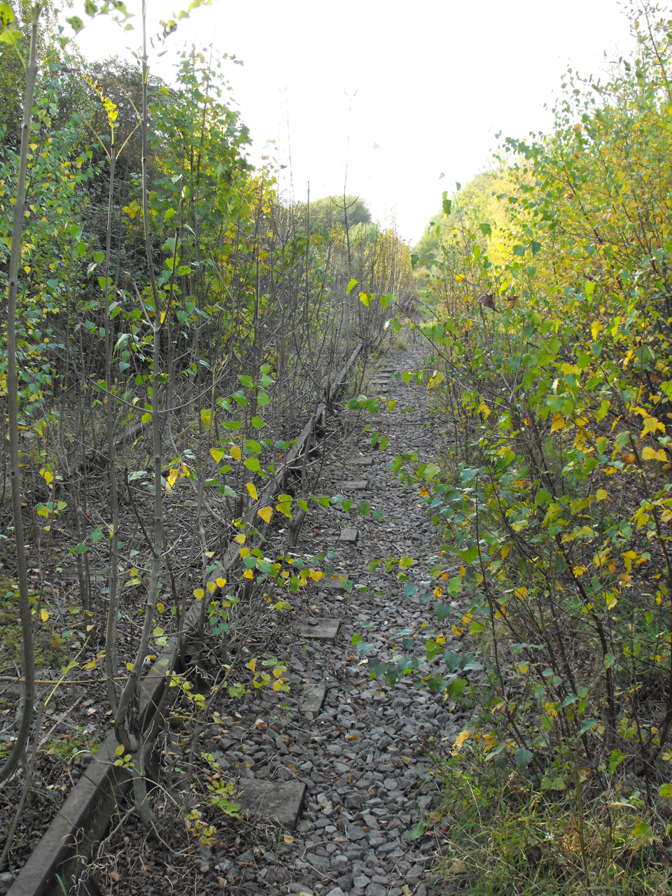 015. View to west from Verney Junction (July 2011) Photo: John Henderson |
Verney Junction cleared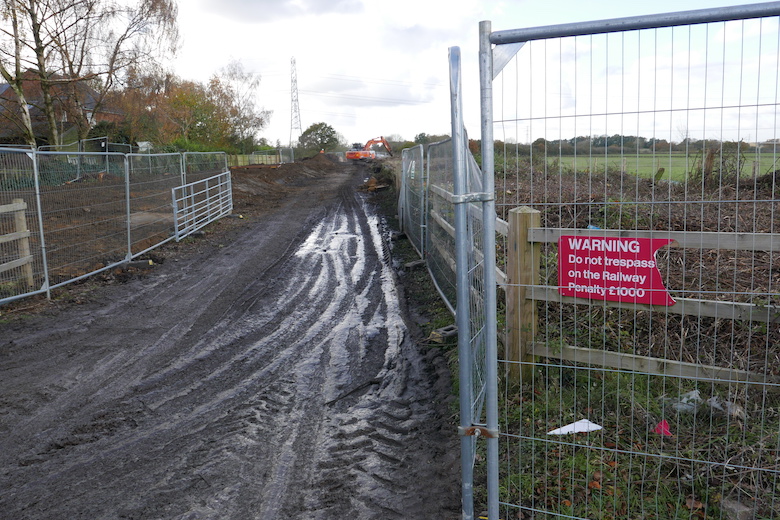 016. View to west from Verney Junction (November 2020) Photo: John Henderson |
|
| Displayed 90 photos. | ||
Railfuture is grateful to Dave Brewerton, Peter Bayless, John Elvin, John Henderson, Peter Wakefield and others (who retain the copyright) for permission to use photos on this website. |
||
Don't forget to register your support with Railfuture
Please click Register Support to enter your details so that Railfuture knows who supports the scheme.